Title Surveys
Title surveys are essential for real estate transactions, providing a detailed description and mapping of tile/property boundaries. This involves a careful investigation of elements which may affect said boundaries, i.e., rights of way, easements, servitudes, and encroachments. At Southeast Engineers, our experienced team conducts meticulous title surveys, delivering accurate documentation that can help protect your real estate investments.
Possession Surveys
Possession surveys identify the existent boundaries and physical occupation of a property within visible, physical bounds or enclosures. This service helps illustrate how the land has been occupied and/or possessed historically. We apply advanced surveying techniques to provide accurate possession surveys, offering peace of mind to property owners and stakeholders.

Riparian Boundaries
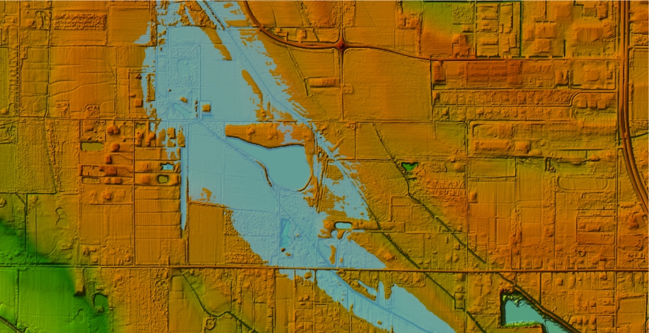
Riparian boundary surveys determine property lines bordering bodies of water, like rivers, lakes, bayous, or streams. These surveys are vital for establishing water rights, managing development, conservation efforts, and resolving boundary disputes. Our expertise in specialized boundary surveys ensures accurate property line mapping, providing essential data for responsible land and water resource management.
Water Bottom Studies
Water bottom studies capture detailed, physical topographical data to identify historical ordinary low water elevations dating back to Louisiana's statehood in 1812. These studies play a key role in determining ownership rights to the minerals beneath the water body or bed.
Construction Staking
Construction staking translates architectural and engineering designs into physical markers on a construction site, guiding contractors during the building process. Accurate staking helps ensure structures are built according to plan, within legal boundaries, and at the correct elevations. Southeast Engineers offers precise construction staking services, helping clients facilitate efficient and error-free construction projects.
Elevation Certificates
Elevation certificates provide information about a property's elevation relative to the base flood elevation, as determined by the National Flood Insurance Program. These certificates are necessary for flood insurance purposes and compliance with local floodplain management regulations.
Our team at Southeast Engineers delivers accurate elevation certificates, assisting property owners in obtaining appropriate insurance coverage while maintaining regulatory compliance.
Pre-Slab Surveys / Building Form Surveys
Pre-slab or building form surveys are conducted before pouring concrete slabs to verify that the building's foundation is positioned correctly on the site. These surveys ensure compliance with design plans, zoning laws, setback requirements, and other regulations. Southeast Engineers provides thorough pre-slab surveys, helping to prevent costly errors and ensuring a solid foundation for a wide range of construction projects.
ALTA / NSPS Land Title Surveys
ALTA/NSPS land title surveys are comprehensive surveys that meet the standards set by the American Land Title Association and the National Society of Professional Surveyors. Our detailed surveys identify property boundaries, easements, encroachments, and other critical land features to help buyers, lenders, and developers make well-informed decisions.
By adhering to rigorous industry standards, we deliver the precise documentation needed for smooth property transfers, risk mitigation, and compliance with legal and financial requirements.
Staking Proposed Well Locations & Preparation of Permit Plats
Accurate staking of proposed well locations and preparation of permit plats are critical steps in the oil and gas industry. These services ensure that drilling sites are correctly positioned and comply with all local, state, and federal regulatory requirements. Southeast Engineers offers expert staking and permit plat preparation for efficient and compliant resource extraction operations.
Location of P & A Wells
Plugged and abandoned (P&A) wells must be accurately mapped for environmental safety, land development, and regulatory requirements. At Southeast Engineers, we use advanced surveying technology to accurately identify and document P&A well locations. Our detailed data helps developers, landowners, and regulatory agencies prevent potential hazards and ensure compliance. With our expertise, clients can confidently plan land use while prioritizing safety and sustainability.
Lease Site Surveys
Lease site surveys define the boundaries and features of land designated for leasing, particularly in industries like oil, gas, and agriculture. These surveys provide critical information for lease agreements, ensuring all parties have a clear understanding of the leased area's extent and characteristics. Southeast Engineers provides clients with precise lease site surveys for the most transparent and equitable leasing arrangements.
Pipeline Surveys / Right-of-Way Plats / Alignment Sheets
Pipeline surveys, right-of-way plats, and alignment sheets play a crucial role in the planning, construction, and maintenance of pipeline infrastructure. These services accurately map proposed pipeline routes, define which properties will be crossed, and ensure compliance with regulatory requirements.
At Southeast Engineers, we deliver precise and comprehensive pipeline surveying solutions, helping clients navigate complex land use challenges while prioritizing safety and efficiency. Our expertise supports the seamless transport of resources, minimizes risks, and ensures projects meet industry standards from beginning to end.
Mineral Lease Boundary Surveys
Mineral lease boundary surveys define the exact limits of land designated for exploration and resource extraction. Accurate boundary mapping helps avoid disputes, optimize resource management, and maintain regulatory requirements.
At Southeast Engineers, our skilled surveyors provide detailed and accurate mineral lease boundary surveys, giving clients the confidence to develop their assets efficiently and responsibly. With our expertise, you can maximize resource potential while ensuring seamless adherence to industry regulations.
Well Unitization Surveys of Order Issued by the Office of Conservation
Unitization surveys are performed to outline the boundaries of a mineral unit, a defined area of land containing a shared oil or gas reservoir that is used to determine the ownership percentage of each mineral rights holder within that unit. These surveys accurately map subsurface property lines to ensure fair distribution of mineral ownership percentages among rights holders within the unit.
Drill Site Area Surveys
Drill site area surveys assess and map the specific locations designated for drilling operations, providing detailed information on topography, access routes, and environmental considerations. At Southeast Engineers, we deliver accurate and comprehensive drill site surveys, equipping clients with the data needed for safe and successful drilling operations. Our expertise helps simplify project execution while supporting responsible land use and environmental stewardship.
Preparation of Corps of Engineers Drawings
Creating drawings for the U.S. Army Corps of Engineers requires meticulous planning and adherence to strict federal standards, particularly for projects impacting navigable waters and wetlands. These detailed plans are essential for obtaining permits, ensuring compliance, and supporting successful project execution. At Southeast Engineers, we produce accurate, high-quality drawings for the U.S. Army Corps of Engineers that keep projects on track. Our expertise helps clients navigate complex regulatory requirements with confidence.
Contact Us
To talk with an engineering professional, request additional information about our services, and other inquiries, please call our office directly or fill out the contact form here. Contact us, today!
*REQUIRED